I was planning a camping trip last spring and pulled up an interactive disaster map to look at the trail area. While I had the map open, I zoomed out to my own neighborhood — something I had never bothered to do before. There it was: a FEMA Zone AE flood hazard designation covering a swath of land that included my street. I had lived there for four years and had no idea. The floodplain came within 200 feet of my foundation. One major storm event and my basement could be underwater.
Understanding what these maps are actually showing you transforms them from abstract colored zones into actionable intelligence. Here is what the major disaster risk layers mean in plain terms.
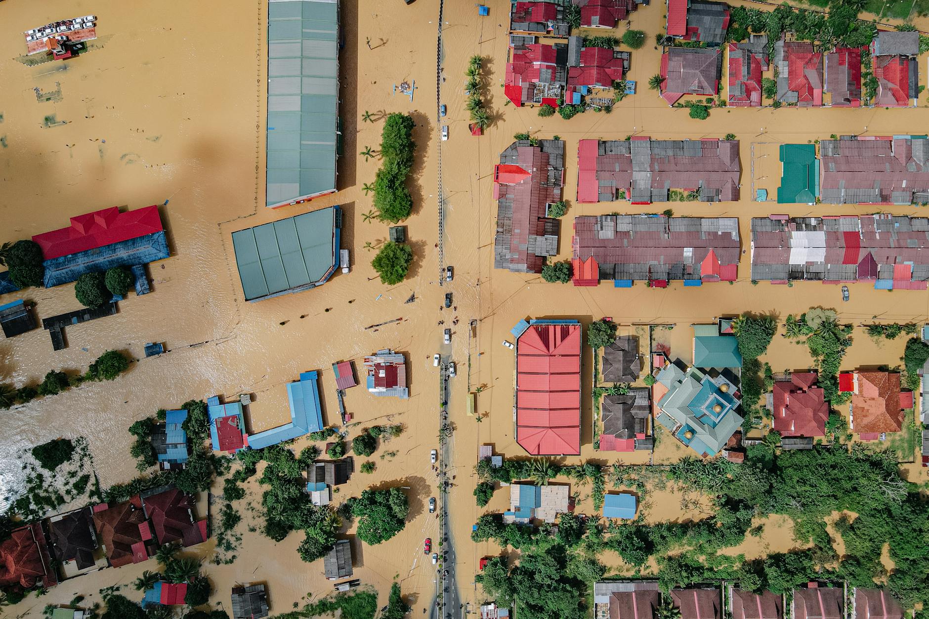
FEMA Flood Zones
FEMA’s National Flood Insurance Rate Maps (FIRMs) classify flood risk into several zone types:
Zone AE: High-risk. Base flood elevation (BFE) has been calculated and is shown on the map. There is a 1% annual chance of flooding (the “100-year flood”). Over a 30-year mortgage, that is a 26% cumulative probability of at least one flood event. Flood insurance is typically mandatory for federally-backed mortgages in this zone.
Zone A: High-risk. Similar to AE but without a calculated BFE. Common in areas where detailed engineering analysis has not been completed.
Zone X: Moderate to low risk. Outside the 100-year floodplain. Flood insurance is not required but may still be advisable. Note that roughly 20% of all flood insurance claims come from Zone X properties — “outside the floodplain” does not mean flooding cannot happen.
Zone V: High-risk coastal areas subject to wave action in addition to flooding. Highest risk category.
Use the Disaster Map to see which zone your property falls in and whether your flood risk designation has changed in recent years — FEMA updates flood maps as development and hydrology change.
Earthquake Risk Zones
Seismic hazard maps show the probability of strong ground shaking over a 50-year period. They typically reference the Modified Mercalli Intensity (MMI) scale:
- MMI V-VI: Weak to moderate shaking, felt widely, minor damage
- MMI VII-VIII: Strong to severe shaking, significant structural damage to older buildings
- MMI IX+: Violent shaking, major structural damage to engineered buildings
California, the Pacific Northwest, the New Madrid Seismic Zone (central US), and Alaska have the highest seismic hazard. But moderate risk exists across much of the country. The key prep implication: older unreinforced masonry buildings and soft-story apartment buildings are most vulnerable. Know what your structure is.
Wildfire and the Wildland-Urban Interface
The Wildland-Urban Interface (WUI) is the zone where developed land meets or mixes with undeveloped, vegetated land. Homes in the WUI face dramatically elevated wildfire risk because fire can approach from multiple directions through continuous vegetation.
Maps showing WUI zones combined with historical fire perimeters give you a clear picture of your wildfire exposure. If you live in a red or extreme risk zone, the prep implications are specific: defensible space of 30 to 100 feet around structures, ember-resistant vents and roofing, home hardening against radiant heat exposure, and early evacuation protocols.
Tornado Risk Corridors
Tornado frequency maps show historical occurrence rates by county or region. The highest-frequency corridor runs through central Texas, Oklahoma, Kansas, Nebraska, and South Dakota — but significant tornado activity occurs across the entire Southeast, Midwest, and Great Plains.
Frequency maps are not forecasts. They show historical patterns. A location with lower historical frequency can still be hit. The prep implication is structural: safe rooms, reinforced closets, and knowing your warning systems are more important than risk level for tornadoes.
Hurricane Storm Surge Zones
For coastal residents, storm surge maps are often more dangerous than wind category maps. A Category 1 hurricane making landfall over a shallow coastal bay can produce the same storm surge as a Category 3 making landfall elsewhere due to geography. NOAA’s SLOSH model produces storm surge prediction zones (A through E) for most coastal areas.
Zone A is lowest elevation and highest surge risk — often inundated even by tropical storms. Zone E is highest elevation and lowest risk. Know your zone, and know that evacuation decisions for coastal residents should be based on storm surge zones, not just wind category.
Warning
A “low risk” designation is a statistical probability, not a guarantee. Events outside their designated frequency happen. A Zone X property outside the 100-year floodplain can flood. A region with low earthquake risk can experience ground movement. “Low risk” means “prepare anyway, just with different priority level” — not “skip preparation entirely.”
Putting It Together
Run your address through the Disaster Map and activate all relevant layers for your geography. Note which risk categories apply, and use that information to prioritize your preparedness efforts. A Zone AE flood resident needs a flood-specific plan. A WUI wildfire resident needs a defensible space and rapid evacuation plan. The risk map tells you where to focus.
For translating that risk knowledge into action, the Family Emergency Evacuation Plan guide covers how to build a plan around your specific hazard profile. And the Emergency Communication Plan covers how to coordinate with household members when a threat is actually developing.
Know your risks. Plan for them specifically. Generic preparedness is better than nothing, but risk-specific preparation is what actually matches preparation to reality.