Okay so I’ve been tracking my pace count for three years now and I still think it’s one of the most underrated navigation tools that basically nobody talks about anymore. Everyone just opens Google Maps. Which, fine — I get it. But your phone battery dies. GPS gets spotty under dense canopy. And at night in unfamiliar terrain, knowing you’ve walked exactly 847 meters northeast is the difference between camping where you planned and being genuinely lost.
Pace counting is dead reckoning. You know your start point, you know your direction, and you know how far you’ve walked. That’s enough to put yourself on a map with pretty solid accuracy — I’d say within 5-10% error over a kilometer, which is actually useful precision in the field.
Here’s the math, and then the application.
Table of Contents
- What Is Pace Count?
- How to Calculate Your Personal Pace Count
- Building a Ranger Bead Counter
- Dead Reckoning Navigation Step by Step
- Adjusting for Terrain and Conditions
- Combining Pace Count with Compass
- Practice Drills That Actually Work
- Common Errors and How to Fix Them
What Is Pace Count? {#what-is-pace-count}
A pace count is the number of times your right foot (or left — pick one and be consistent) hits the ground per 100 meters of travel. That’s it. One “pace” = two steps. Right foot hits: one pace. Right foot hits again: two paces. You count only every other step.
Why 100 meters? That’s the standard military measurement unit for land navigation. A topographic map in 1:25,000 scale has grid squares that are 1,000 meters on each side. 100-meter intervals divide cleanly into those grid squares: 10 intervals = one grid square traversed.
The average adult has a pace count of about 62-66 paces per 100 meters on flat terrain. I’ve measured mine at 64. A hunting buddy with a longer stride comes in at 58. Another buddy with a shorter stride measured 71. Yours will be different from all of ours, which is exactly why you have to measure it yourself.
Do not use someone else’s pace count. It will compound your error with every interval.
How to Calculate Your Personal Pace Count {#calculate-yours}
You need a known 100-meter distance and a flat surface. This is easiest to set up on a football field (the field is 91.44 meters — close enough for calibration) or by using a measuring wheel, or by using GPS on your phone to mark a 100-meter stretch of trail.
Method:
- Stand at your start point. Reset your mental counter to zero.
- Walk your natural walking pace — don’t try to lengthen or shorten your stride. Just walk normally.
- Count every time your right foot hits the ground until you’ve covered 100 meters.
- Write down the number.
- Repeat three times.
- Average the three numbers. That’s your pace count.
Example: If you count 63, 64, 63 — your pace count is 63.3, which you’d round to 63.
My pace count calibration setup at home: I marked 100 meters in our backyard with stakes. I measured it with a 300-foot measuring tape, then used a GPS receiver to verify. The two measurements matched to within 0.3 meters, which is close enough for navigation purposes.
Pro Tip: Recalibrate your pace count at different elevations if you’re going to high-altitude terrain. I measured 67 paces per 100 meters at sea level and 70 at 9,000 feet — thinner air, slightly shorter steps. That 4.5% difference compounds over 2-3 kilometers of navigation.
Building a Ranger Bead Counter {#ranger-beads}
Counting to 1,000 meters by keeping a running total in your head is how you make errors. A ranger bead counter solves this.
Build one using 550 paracord and beads, or buy a pre-made one for about $6.
Standard configuration: 9 beads on the bottom section, 4 beads on the top section.
How it works:
- Start with all beads pushed up (away from the knot at bottom)
- Every 100 meters, slide one bottom bead down
- After 9 bottom beads are down (900 meters), slide one top bead down and reset all bottom beads up
- After 4 top beads are down, you’ve traveled 4,000 meters (4 kilometers)
- Reset all beads and start again, noting on your map that you’ve covered 4km
The top section gives you up to 4 kilometers before a full reset. If you need to track longer distances, note your position on the map at each 4km reset.
A ranger bead counter attaches to your pack strap, sleeve, or belt loop with a quick-release. It becomes automatic — you don’t have to think about it once the habit is built.
Dead Reckoning Navigation Step by Step {#dead-reckoning}
Dead reckoning means: I know where I started, I know what direction I went, and I know how far I went. Therefore I know where I am.
Combined with a topographic map and compass, this gives you position tracking even with no GPS, no landmarks, no cell service.
The process:
- Mark your start point on your map. Put a pencil dot on your known position.
- Set your compass bearing. Determine which direction (azimuth) you need to travel to reach your destination. Shoot your bearing.
- Begin traveling and counting paces. Maintain your bearing, count paces.
- At each 100-meter interval, slide a bead down.
- Plot your position. On your map, measure 100 meters in the direction of travel from your last known point using your map scale. Mark a new dot. This is your estimated current position.
- Continue or correct as needed. If you encounter a recognizable landmark (ridgeline, stream crossing, trail junction), use it to verify your position and correct any accumulated error.
The more often you check your position against terrain features, the more accurate your navigation stays. Don’t wait until you’re completely lost to look at the map.
Adjusting for Terrain and Conditions {#terrain-adjustments}
Your pace count changes significantly based on conditions. Knowing the typical adjustment factors lets you correct your estimates.
| Condition | Typical Effect on Pace Count |
|---|---|
| Uphill (steep) | +5 to +15 paces per 100m |
| Downhill (steep) | -5 to +10 paces per 100m |
| Dense brush/vegetation | +10 to +20 paces per 100m |
| Sandy/loose soil | +5 to +10 paces per 100m |
| Snow (deep) | +15 to +25 paces per 100m |
| Night travel | +5 to +10 paces per 100m |
| Heavy pack load | +3 to +8 paces per 100m |
These are approximations — your specific adjustments depend on your stride and the specific terrain. The only accurate method is to calibrate on different terrain types when you have GPS available for comparison.
My approach: I have separate pace counts calibrated for flat trail, uphill, downhill, and brush. I wrote them on a waterproof card that I keep in my navigation kit. When terrain changes, I switch to the appropriate pace count mentally.
Combining Pace Count with Compass {#with-compass}
A pace count without a compass is interesting but incomplete — you know how far you went but not which direction. A compass without a pace count tells you direction but not distance. Together, they give you full dead reckoning capability.
For wilderness navigation, the baseline map and compass skills are the foundation. Pace count layers on top of that foundation.
Practical sequence for a backcountry leg:
- At your start point: identify your position on the map
- Identify your destination: note the grid coordinates or terrain feature
- Draw a line on the map from start to destination
- Measure the line length using your map scale — note distance in meters
- Shoot a compass bearing along that line (accounting for declination)
- Set your pace count beads to zero
- Walk on bearing, counting paces
- Stop when pace count equals calculated distance
- Verify position with terrain features
If you’re off — and you often will be by some amount — look around for the nearest identifiable terrain feature. A distinctive ridgeline, a stream, a junction. Use that to correct your position.
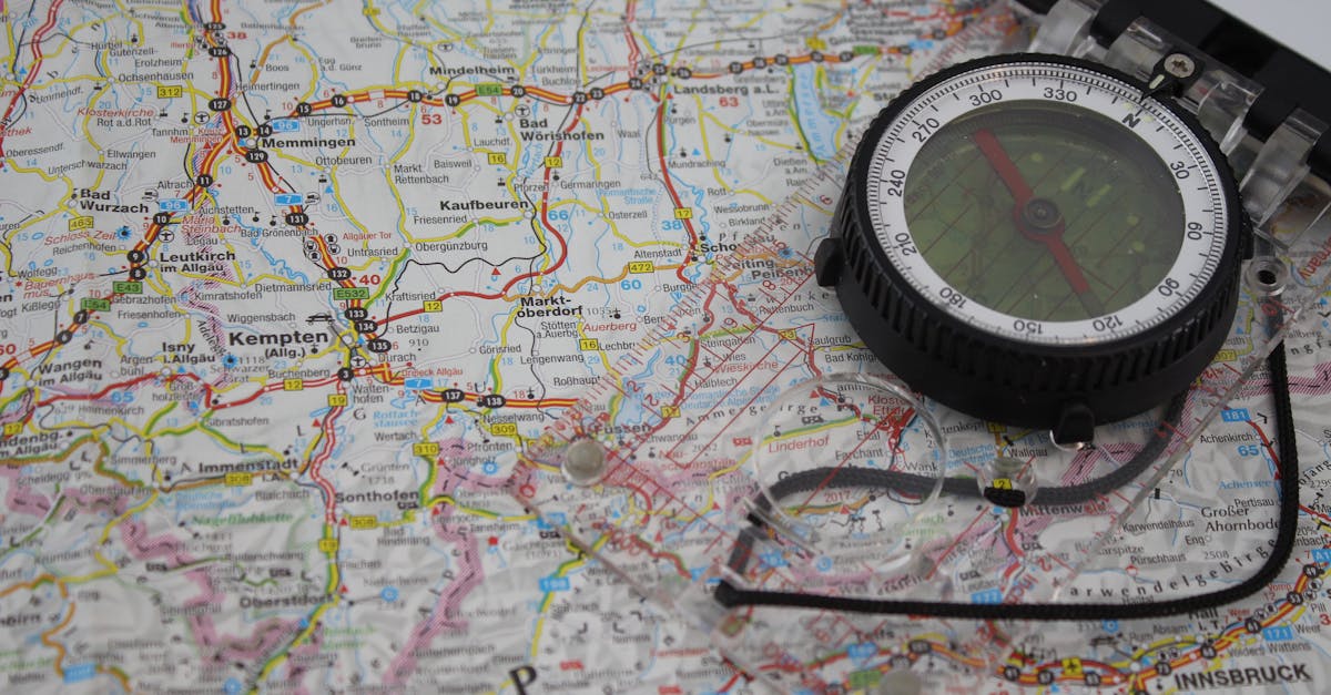
A good military-style lensatic compass makes bearing-shooting much easier than a basic orienteering compass. The sighting wire and bezel system lets you maintain a precise heading while walking terrain that constantly tempts you to drift.
Practice Drills That Actually Work {#practice}
You won’t trust a skill you’ve never used under low-stakes conditions. Practice in your neighborhood before you need pace counting in the backcountry.
Drill 1: Known-distance verification Using your phone GPS as ground truth, walk a known distance (say, 500 meters north on a flat road). Count your paces. Check how far off your estimate was. Repeat.
Drill 2: Object recovery Go to a park or open area. Plant a marker (a hat, a pack) at a known location. Walk 200 meters on a compass bearing, marking your path. Turn 90 degrees, walk another 200 meters. Turn 90 degrees again, walk 200 meters back toward where you started. How close are you to your original marker?
I first did this drill at 13 in an open field near home. I missed my marker by about 15 meters. A buddy doing the same drill — who didn’t take the pace counting seriously and was just guessing — missed by about 60 meters. That margin matters when the marker is your camp.
Drill 3: Night navigation Same as Drill 2, but after dark. Night navigation is harder — you walk more slowly, more carefully, and your pace count goes up. But the drill builds confidence for real situations.
Common Errors and How to Fix Them {#errors}
Counting every step instead of every other step. This doubles your pace count and makes everything wrong. Count only right foot hits.
Losing count in rough terrain. If you fall, scramble over an obstacle, or get distracted — pause, note approximately where you are, then restart. It’s better to have a clean restart than a corrupted count. Use the ranger beads so you only have to hold 9 numbers in your head max.
Not accounting for terrain variation. Assuming your flat-ground pace count applies in dense brush will put you 20% short of where you think you are after a kilometer.
Forgetting to reset at waypoints. If you stop to check your map and plot position, reset your bead counter before continuing. Easy to forget.
Drifting off bearing. Pace count is worthless if you’re not traveling in the right direction. Check your compass every 5-10 paces in thick brush. On open terrain, pick a landmark on your bearing and walk to it, then shoot the next landmark.
The math isn’t complicated. The discipline to execute consistently — that’s the actual skill. The data from wilderness navigation studies shows that dead reckoning accuracy degrades significantly when people skip the calibration step or fail to account for terrain conditions. Calibrate, note your adjustments, and use the beads. That’s the whole system.
One more thing: pace count is a backup skill, not a primary one. Use your GPS receiver when you have it. Use landmarks when you can see them. Read the topo when the terrain is distinctive enough to locate yourself. Pace count fills the gap when everything else fails.
And if you want to build the full navigation toolkit, check out the wilderness navigation guide — it covers map, compass, stars, and natural navigation cues as a complete system.