This article contains affiliate links. We may earn a small commission if you purchase through these links, at no extra cost to you.
A few years ago I spent several months building out an earthquake preparedness system — strapped furniture to walls, stored supplies in rigid containers, practiced drop-cover-hold-on drills. Then a severe ice storm knocked out power for five days and left my driveway impassable for three. I was completely unprepared for winter storm scenarios. All my prep was pointed at the wrong target, and I discovered that gap by living through it rather than planning for it.
Preparedness built around the wrong risks is almost as dangerous as no preparedness at all. Here are the five most common mistakes that come from ignoring your local risk profile.
Mistake 1 — Preparing Generically Instead of for Your Specific Hazards
A generic emergency kit with three days of food, some water, and a flashlight is better than nothing. But it is not a plan — it is a starting point that ignores everything specific about where you live.
Someone in Florida’s coastal counties faces hurricane storm surge, not blizzards. Someone in earthquake country needs structural retrofits and a drop-and-cover protocol, not hurricane shutters. A household in the Great Plains needs a basement shelter or storm room, not wildfire defensible space.
Start with the Disaster Map, identify your top two or three actual local hazards, and build your plan around those first. Generic prep fills in the gaps after your risk-specific prep is solid.
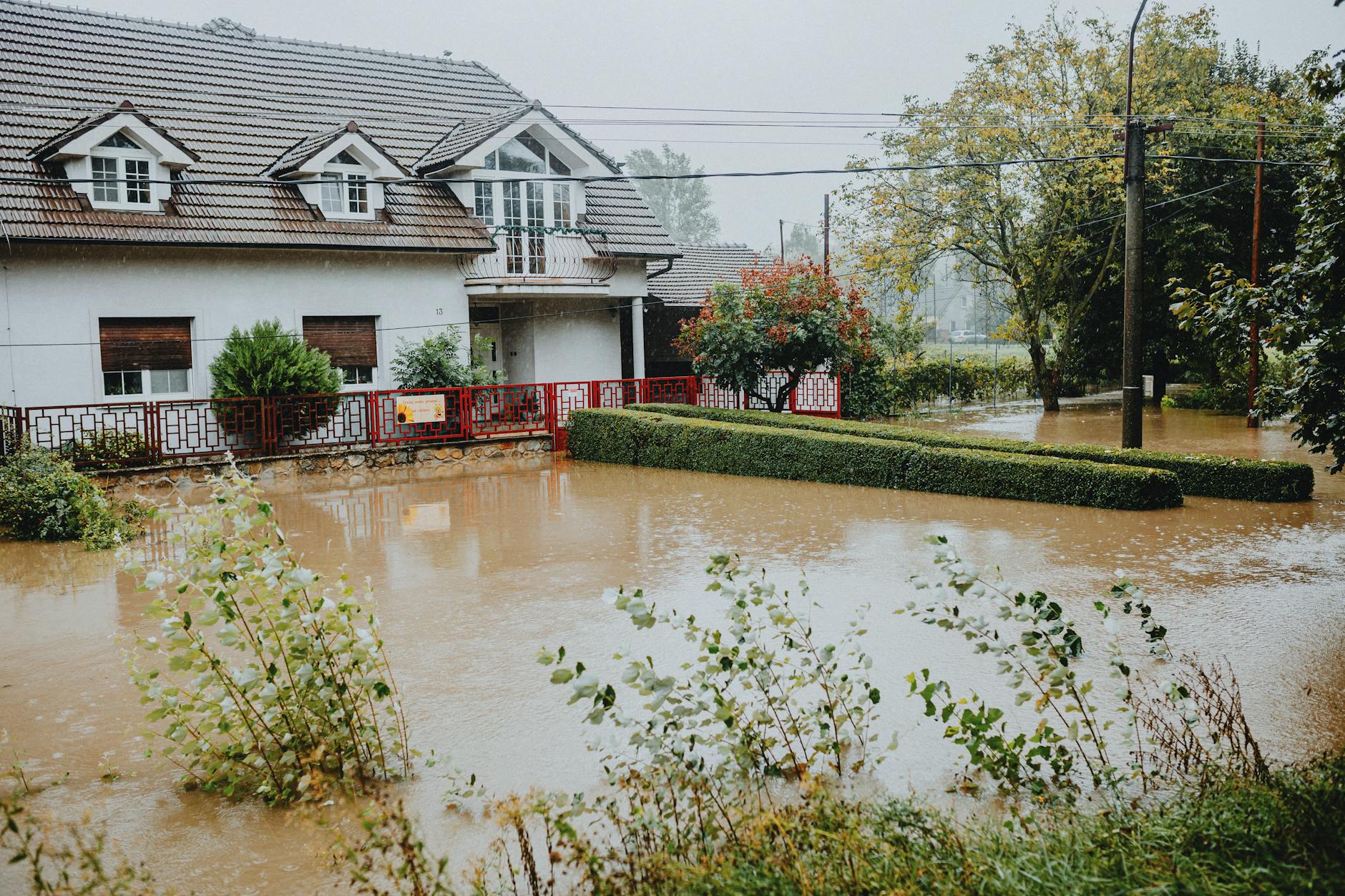
Mistake 2 — Assuming Low Risk Means No Risk
The 100-year floodplain designation (Zone A/AE) gets attention. Zone X, outside that boundary, often leads people to skip flood preparation entirely. But Zone X properties account for roughly 20% of all flood insurance claims in the United States. Flash flooding, urban drainage failure, and localized heavy rain do not respect floodplain boundaries.
Similarly, the New Madrid Seismic Zone in the central United States is a moderate seismic risk area. It is not California, but it has produced some of the largest historical earthquakes in North American history. “Low seismic risk” means lower probability, not zero probability.
Pro Tip
Check the Disaster Map at the start of each storm season — spring (tornado and flood season), late summer (hurricane season for coastal areas), and fall (wildfire season for western states). Risk maps are updated periodically as FEMA revises floodplain boundaries and as new data becomes available. A five-minute check once per season keeps your knowledge current.
Mistake 3 — Not Knowing Your Evacuation Zone or Trigger Points
Every coastal and flood-prone community uses numbered or lettered evacuation zones. Zone A or Zone 1 is typically the highest risk, lowest-elevation area that evacuates first. Zone D or Zone 5 is furthest from immediate threat and evacuates last — or not at all for many events.
Not knowing which zone you live in means you do not know whether an official evacuation order applies to you. During a hurricane, local officials will say “Zone A and B mandatory evacuation” — and if you do not know your zone, you are guessing. Find your zone now at your county emergency management website or through the Disaster Map tool.
Also identify your trigger points: at what point in an event’s development do you leave versus shelter in place? Do not leave this decision for the moment a storm is approaching and roads are congesting.
Mistake 4 — Planning a Single Evacuation Route
One route is one point of failure. During major evacuations, primary roads jam within hours. Bridges flood. Debris from wildfires blocks roads. Traffic accidents stop movement entirely.
Every household needs at minimum two distinct evacuation routes — ideally three — that use different roads and do not share the same bridge crossings or bottleneck points. One should avoid freeways entirely (local routes that go unnoticed during mass evacuations are often faster). Know these routes by driving them when conditions are normal, not by checking GPS during an emergency when cellular networks are overwhelmed.
For building a complete household evacuation plan around your mapped risk, the Family Emergency Evacuation Plan guide covers triggers, routes, meeting points, and out-of-area contact protocols in detail.
Mistake 5 — Waiting Until a Threat Appears to Check the Maps
By the time a specific threat is imminent, store shelves are empty, traffic is building, and emergency information is competing with rumor and social media noise. That is not the moment to open a risk map for the first time and start learning what it means.
The Disaster Map and your official local emergency management resources should be places you have already been — before the season, before the storm, before the fire. Understanding your risk zones, knowing where they are relative to your home, and having already built evacuation routes around them transforms a reactive scramble into an executed plan.
Preparedness that matches your actual local risk is the entire point of the exercise. Generic kits and vague plans are better than nothing, but they leave significant gaps that risk-specific preparation closes.